Corona Del Mar is a well known beach in Souther California, with easy to recognize features (such as staircases, arche rocks, cave).

We used a combination of drone imageries and DSLR ground imageries to create a high-resolution photo-realistic 3D model.
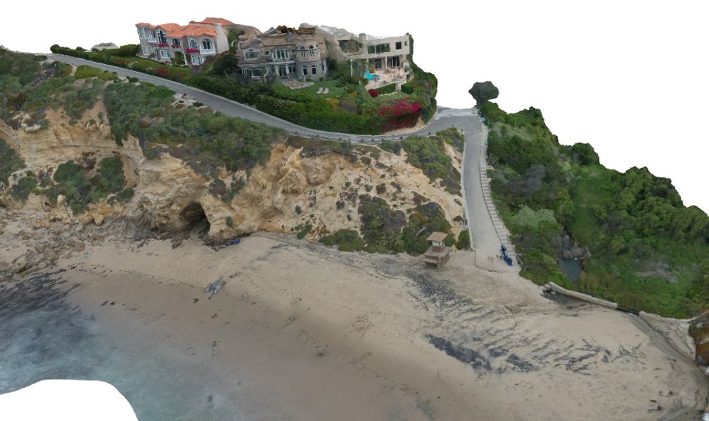
The 3D model created is higly photorealistic and was cleaned in Unity 3D to take care of the shadows, lightning, and white balance.
More information about the project