An inclusive and experiential multi-stakeholder tool
Genesis of the project
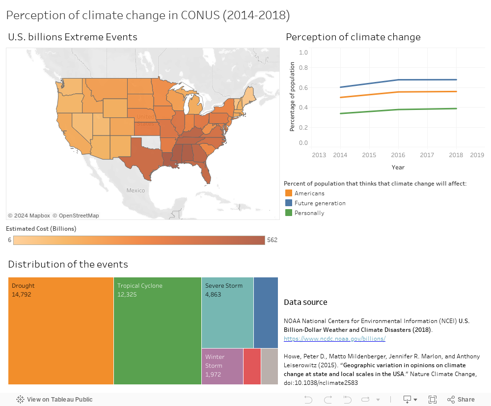
Coastal cities are exposed to a wide range of hazards, and among them, flooding is being magnified by global warming and its direct or indirect effects, such as sea-level rise, change in precipitation patterns and increase of extreme precipitation events. Despite this increase risk well document in the scientific literature, climate change is not yet considered as a direct and personal threat to most of the people living in these areas. A recent survey from the Yale Program on Climate Change Communication shows that while a large majority of Americans believe that climate change is happening (70% National, 76% California) and changing the weather (62% National, 67% California), it is still considered a far and future issue (70% National, 76% California). Only 41% of American thinks that they will be personally impacted by climate change (49% California) (Desssler et al., 2016; Leiserowitz, et al.).
Objectives
The objectives of floodVR are:
- To create an innovative and effective communication tool based on experiential learning.
- Empowering citizens in the decision-making process of their community.
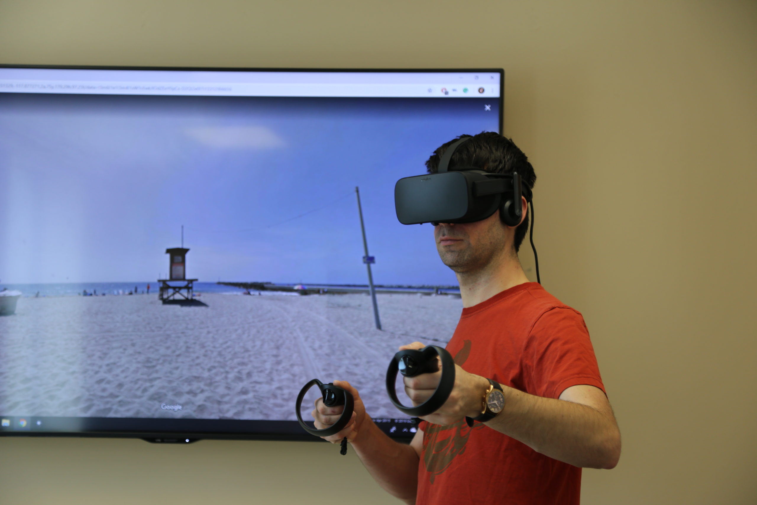
For this purpose, we developed a framework that projects 2D maps into an immersive, virtual, interactive environment. This way, we can translate any scenario outputs from a scientific report into a clear, understandable, and virtual experience. For climate change communication, informing citizens of the benefits of rising a sea-wall, or of the risk of living in some areas, it has many applications to empower all citizens and include the ones who are traditionally excluded from institutionalized top-down decisions.
Development
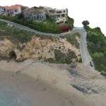
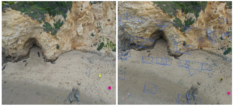
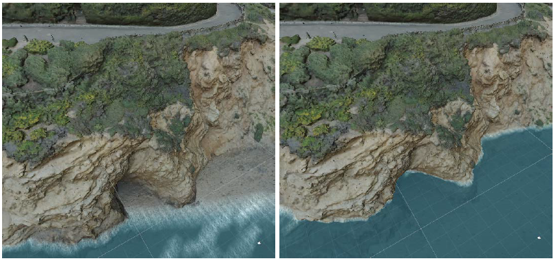
The framework is object a paper (currently under revision) and a link will be added once published. It consists in different steps, data acquisition, flood infomation, 3D rendering, and VR experience. The data acquisition consists in taking UAVs imageries to create a photorealistic 3D model of the area of interest using photogrammetry. The flood information consists in creating an ESRI shapefile of the flood level of the scenarii of interests. The 3D rendering is done in C#in Unity, in which we are adding water levels to the 3D model. The VR experiences consists in adding narrative, interactivity in the 3D environment (such as interacting with object or people, adding links to videos of experts, changing the scenario or parameters of the scenario such as sea level rise, RCP scenario, etc.).
User testing
Due to COVID-19 pandemic, the user testing in Newport Beach Public Library has been cancelled and will be conducted in 2021.
Future development
Future development consists in creating a fully multi-stakeholder versions using a combination of individual VR Goggles and collective Dome Theater with our partner The Elumenati.
Acknowledgement
We would like to acknowledge the following actors which are making the project possible:
- The American Geophysical Union for the seeds money to start the project.
- The Elumenati for the technical support on the ongoing upgrade of the project.